China’s landroof in Himalaya
BY DUNCAN MIL
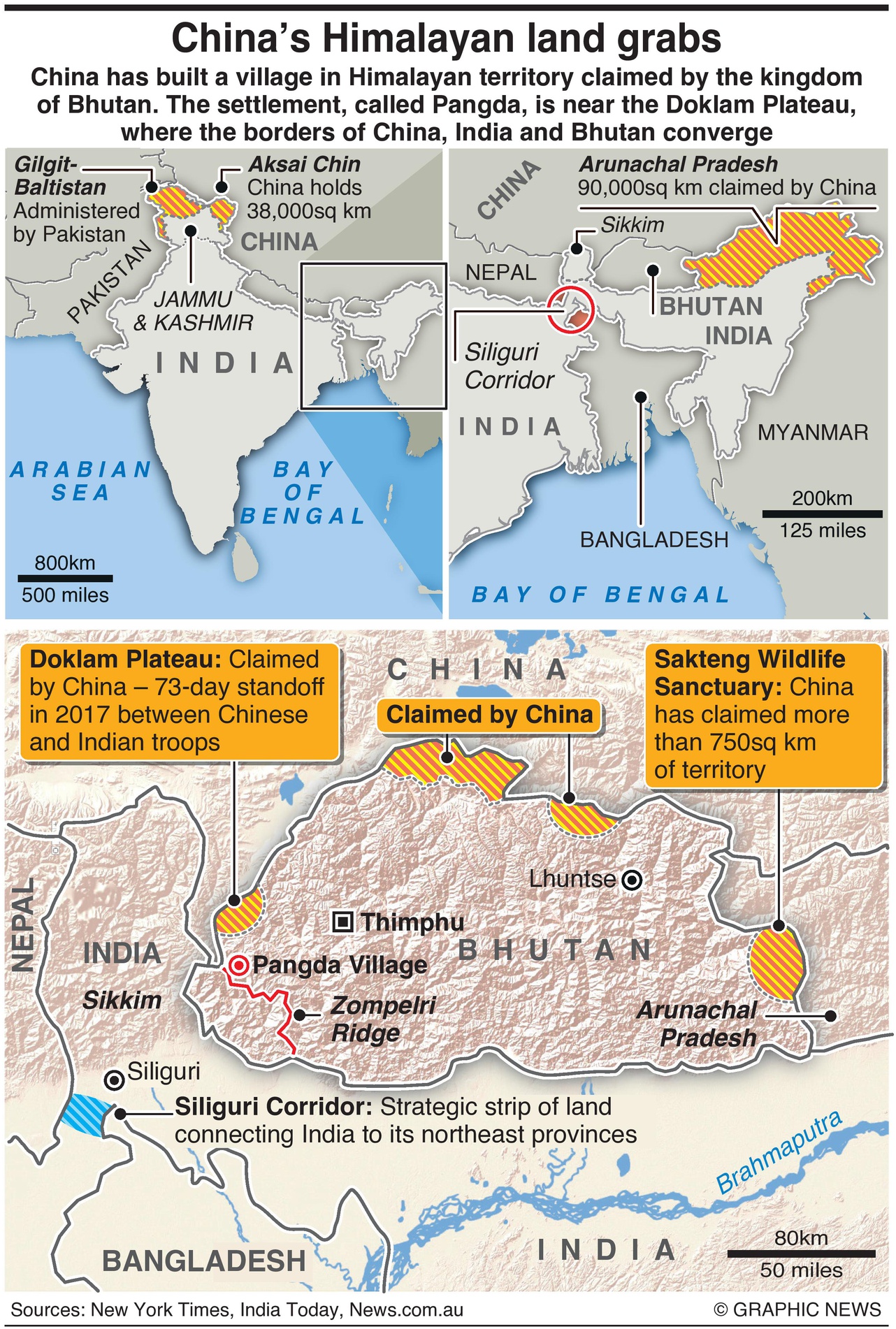
November 30, 2020 – China has built a village in Himalayan territory claimed by the kingdom of Bhutan. The settlement, called Pangda, is near the Doklam Plateau, where the borders of China, India and Bhutan converge.
Satellite imagery shows that the new village lies some two kilometres within Bhutanese territory. Images provided by Colorado-based Maxar Technologies have revealed new hardened ammunition bunkers around seven kilometres from the Doklam Plateau.
In 2017, the plateau was the site of a 73-day standoff between Indian and China’s People’s Liberation Army troops over the construction of a road into Bhutanese territory. That road was to lead to the Zompelri Ridge — a strategic position overlooking the narrow, Siliguri Corridor.
The so-called “Chicken’s Neck” is a narrow choke-point in supply lines to India’s north-eastern states. India, which has a longstanding security pact to defend Bhutan deployed troops to halt the Chinese work.
The Doklam incident was the most severe face-off in decades between India and China until the confrontation in eastern Ladakh — on the Line of Actual Control with Aksai Chin — that peaked in June with a clash that left 20 Indian soldiers dead and an unspecified number of Chinese casualties. China holds 38,000 square kilometres in Aksai Chin.
China added a new claim this summer to more than 750 square kilometres of territory in Bhutan’s Sakteng Wildlife Sanctuary, an area on the border between Arunachal Pradesh and Bhutan. Beijing claims large areas of Bhutan’s northern provinces, as well as 90,000 square kilometres within Arunachal Pradesh.
Between 1984 and 2016, Bhutan and China have held 24 rounds of boundary negotiations. However, talks stalled after the Doklam incident.


